Ice Caps and Sea Levels
Satellite Images
Below are a series of satelitte images with questions that will help you develop a better understanding of ice caps and sea levels.
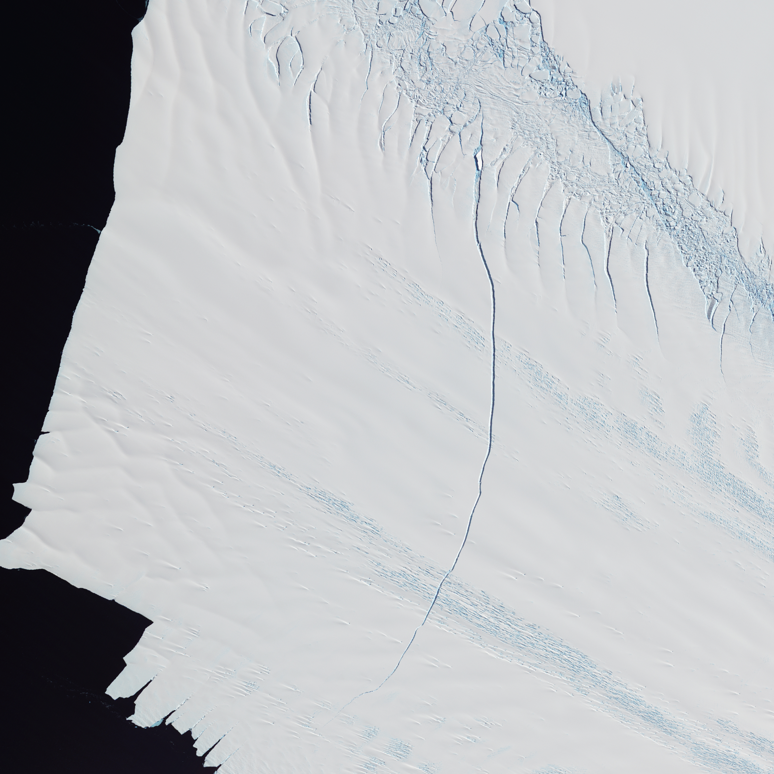
Image 1: Crack in the Pine Glacier
Questions
What do you predict will happen to the glacier because of its major crack?
Hoe does this relate to the process of melting ice caps and sea levels?
Discuss your findings and thoughts on NASATalk.
For more information about the image, go to Featured Data: Crack in Pine Island Glacier.
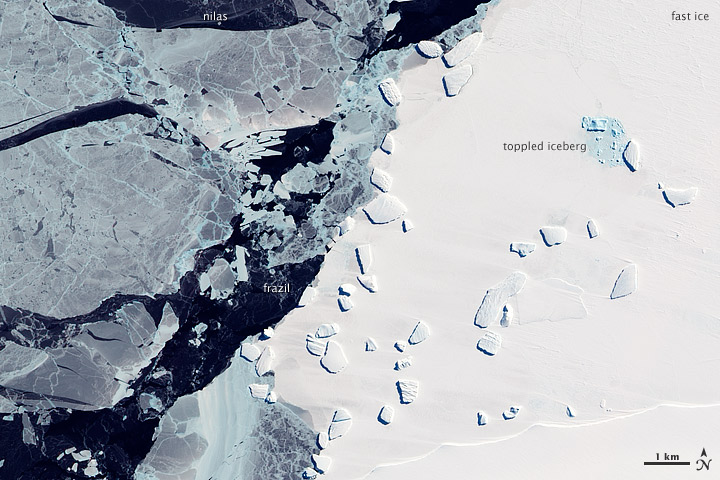
Image 2: Sea Ice and Icebergs off East Antarctica
Question
Can you define any of the different types of ice that are labeled in this image: fast ice, frazil, and nilas?
Discuss your findings and thoughts on NASATalk.
For more information about this image this image, go to Featured Data: Sea Ice and Icebergs off East Antarctica.
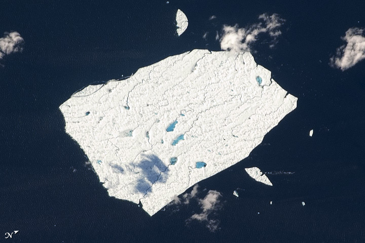
Image 3: Melt Ponds, Petermann Ice Island
Question
This ice island has streams and pools of water on its surface, how do you think this occurs?
Dicuss your findings and thoughts on NASATalk.
For more information about this image, go to Featured Data: Melt Ponds, Petermann Ice Island.
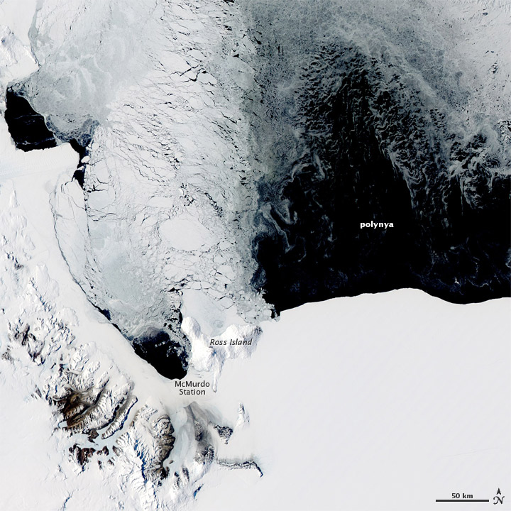
Image 4: Polynya off Antarctic Coast
Question
Sometimes open water appears in places where sea ice should occur. Why does this happen?
Discuss your findings and thoughts on NASATalk.
For more information about this image, go to Featured Data: Polynya off Antartica Coast.
Image 5: Franz Josef Land
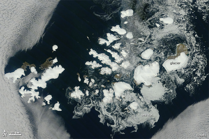
Question
Franz Josef Land is an archipelago of how many islands? Take your best guess!
Discuss your findings and thoughts on NASATalk.
For more information about this image, go to Featured Data: Franz Josef Land.

